
![]() Often when out cycling or walking I find places of interest, good places to take photos, potholes,the location of unusual wildlife, places to shelter from the rain, good places to go tea/cakes/beer etc. What I wanted was an application that I could use to collect this information and share it with others. There are of course services and applications that can assist with this, but I wanted to build my own to do _precisely_ what I wanted. Hence NinePOI, its name due to it being a Ninelocks.com project. So what can NinePOI do?
Often when out cycling or walking I find places of interest, good places to take photos, potholes,the location of unusual wildlife, places to shelter from the rain, good places to go tea/cakes/beer etc. What I wanted was an application that I could use to collect this information and share it with others. There are of course services and applications that can assist with this, but I wanted to build my own to do _precisely_ what I wanted. Hence NinePOI, its name due to it being a Ninelocks.com project. So what can NinePOI do?
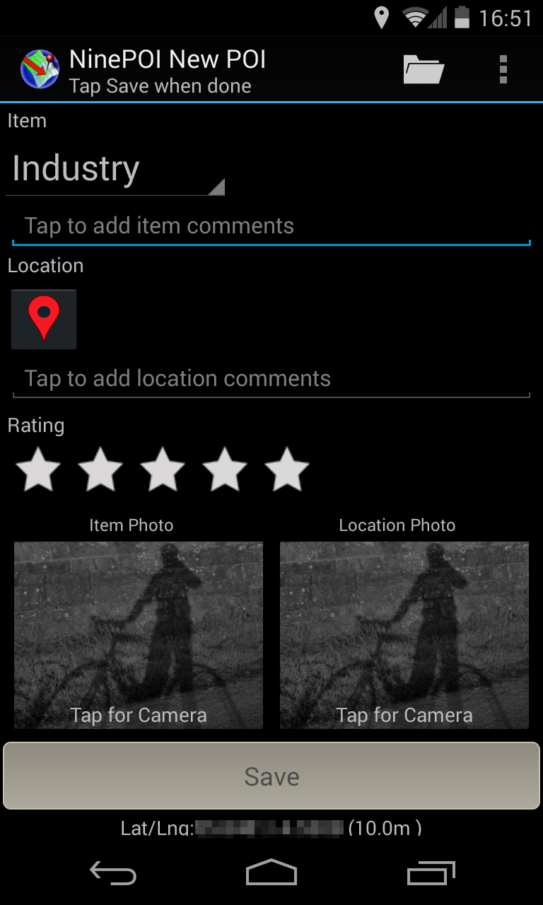
The POI is first captured with up to two photos. One photo is to identify the Point of Interest, the other to give some context about how to find it. The images can also have GeoLocation information embedded in them. If you have data access you can also bring up a Google map and put a pin in your location to show where it is and add some comments about the item and the location and give it a an importance rating of 1-3 stars. Now tap save.
Thats it, POI captured! What can you do with it now? Send it as an email to someone.
The images are automatically attached and the email body contains the notes you took, the geo location of where each photo was taken and a URL of a Googlemap showing the location.
In addition a CSV file containing additional information can be attached as well. Sending an email with photos caters for your friends who dont have an Android phone and NinePOI but for those that do you can send you POI to them as a special POIRecord.
The POIRecord contains the images and all the location information. When a contact receives your POIRecord (by email or downloaded from a website or dropbox) the POI will show in their list of POIs as shown in this screenshot.
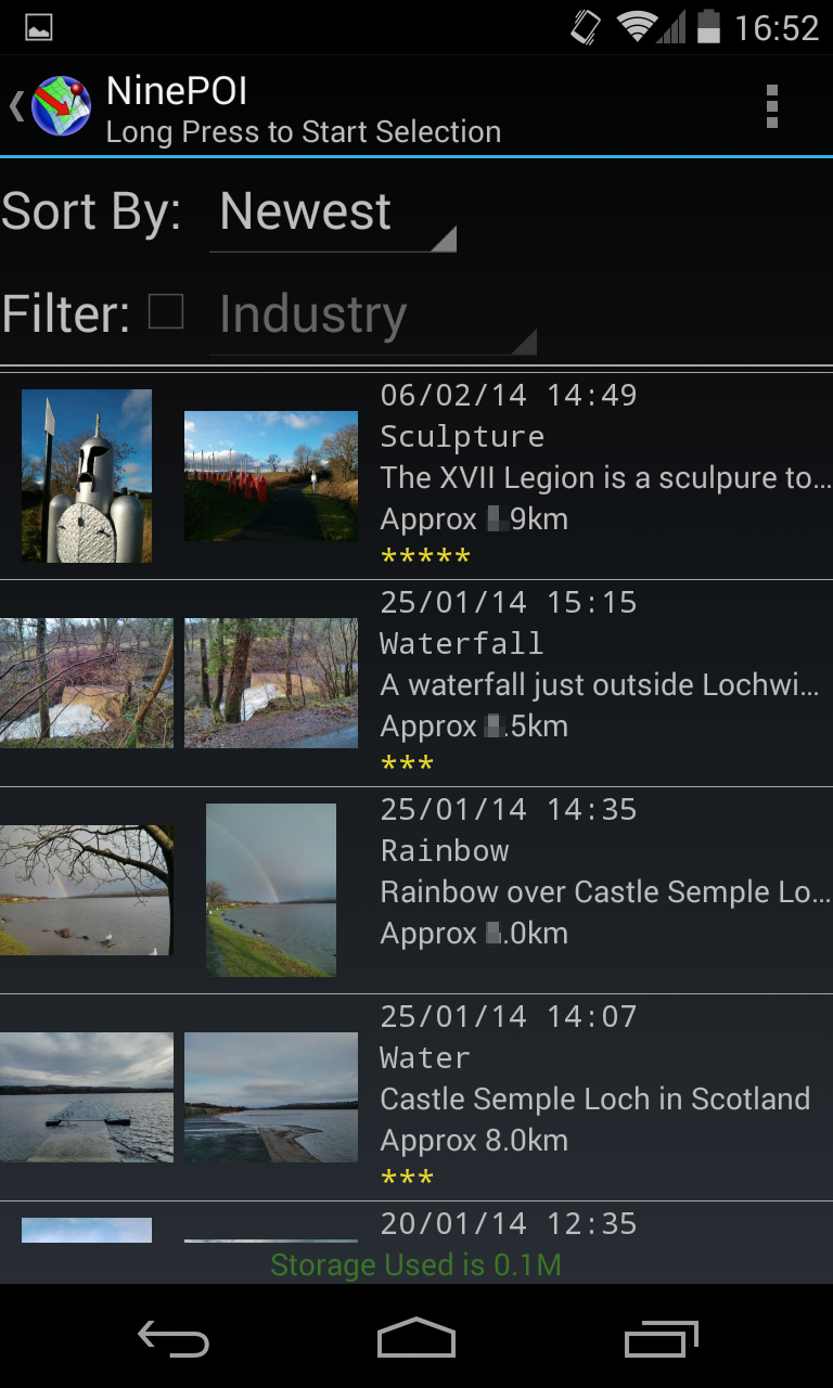
The screenshot above shows a collection of a few POIs. Now Now lets take a closer look at that location with that strange wooden structure on it. Hmm looks interesting and its only 12km away from where I am now…. (yeh sorry, cyclists seem to like kilometres) Lets take a closer look at the record.
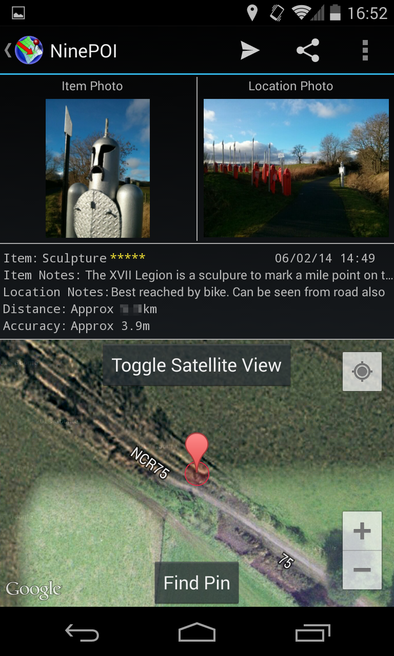
In this view you can see where the POI is on the Map and the comments about the location. If you want a closer look at the photos just tap on them and they will be opened in your phones photo viewer. If your phone does not have a photo viewer (some dont), then the photo will be shown in NinePOIs own viewer. From here the images can also be “shared”, to do that long tap on them and share with suitable applications. (eg some twitter clients). Now how do we get to that location.
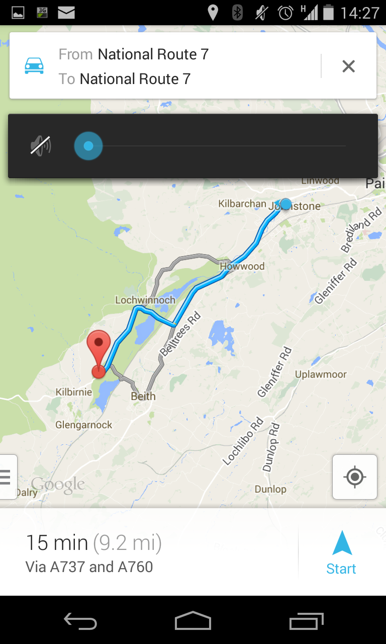
NinePOI can tell me that as well, tap on the navigation icon and NinePOI will open Googlemaps in navigation mode.
 N
N
NinePOI allows me to collect place of interest, find my way back to them and also to share them with other people. If you download the beta to play with there are some test POIs you can download and install here NinePOI has many applications, some ideas below
- Report and note where potholes or other problems are
- Note good locations for photo taking
- Record good places to shelter from bad weather when out walking or cycling
- Note where rare or unusual plants, trees or wildlife is located
- Keep list of favourite food and beverage suppliers on your cycle and walking trips
And yes it is designed for tablets with suitable changes to screen layouts. No doubt there are many others that you can think of. NinePOI will continue to evolve, if it does not have a function you would like, or you find problems with it, let us know via the support email address within the application.
NinePOI is available from the Google Play store, but update and test versions will be here shortly.
If you would like to try NinePOI get in touch!